Here are some maps. Of necessity, the files are
large, so please be patient while they download.
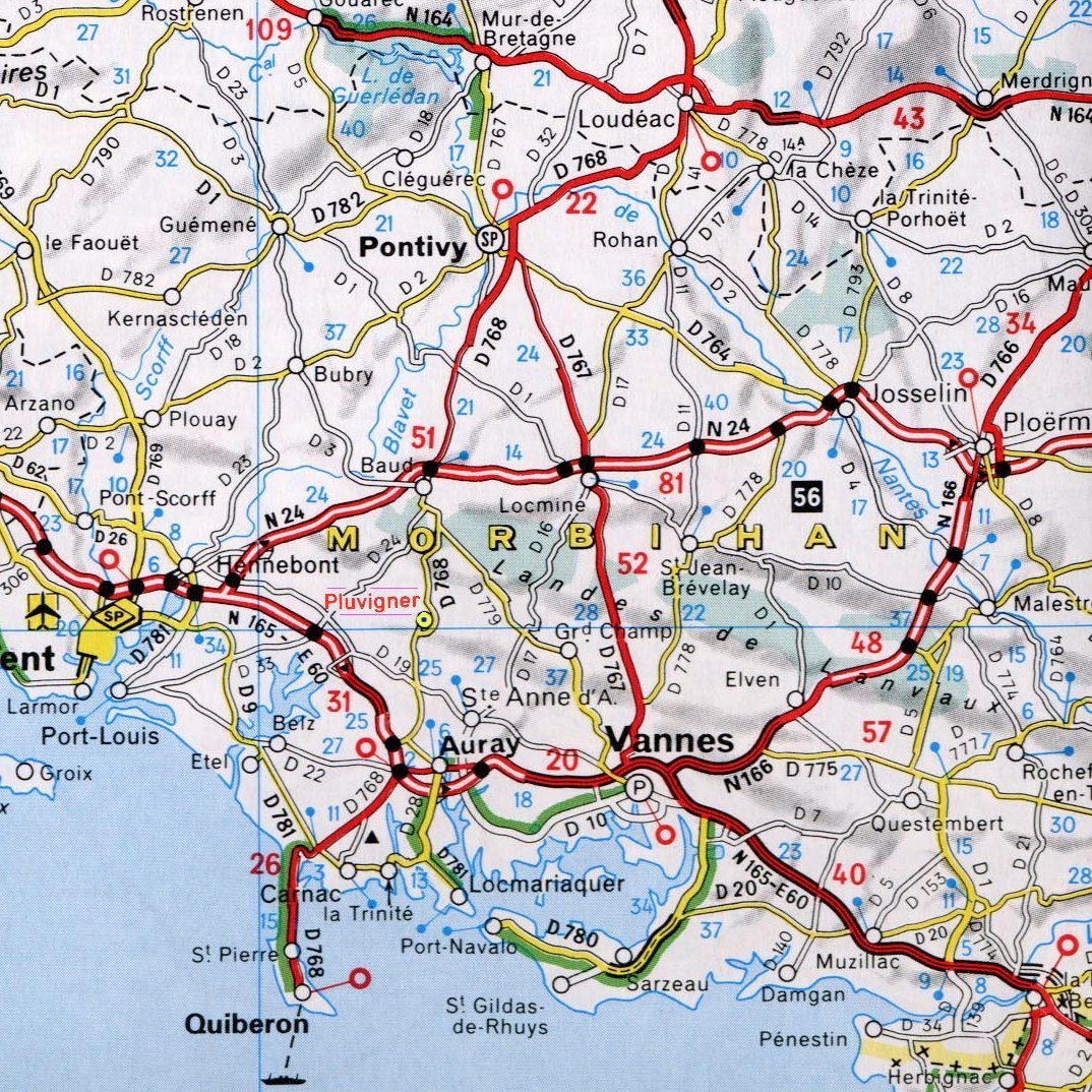
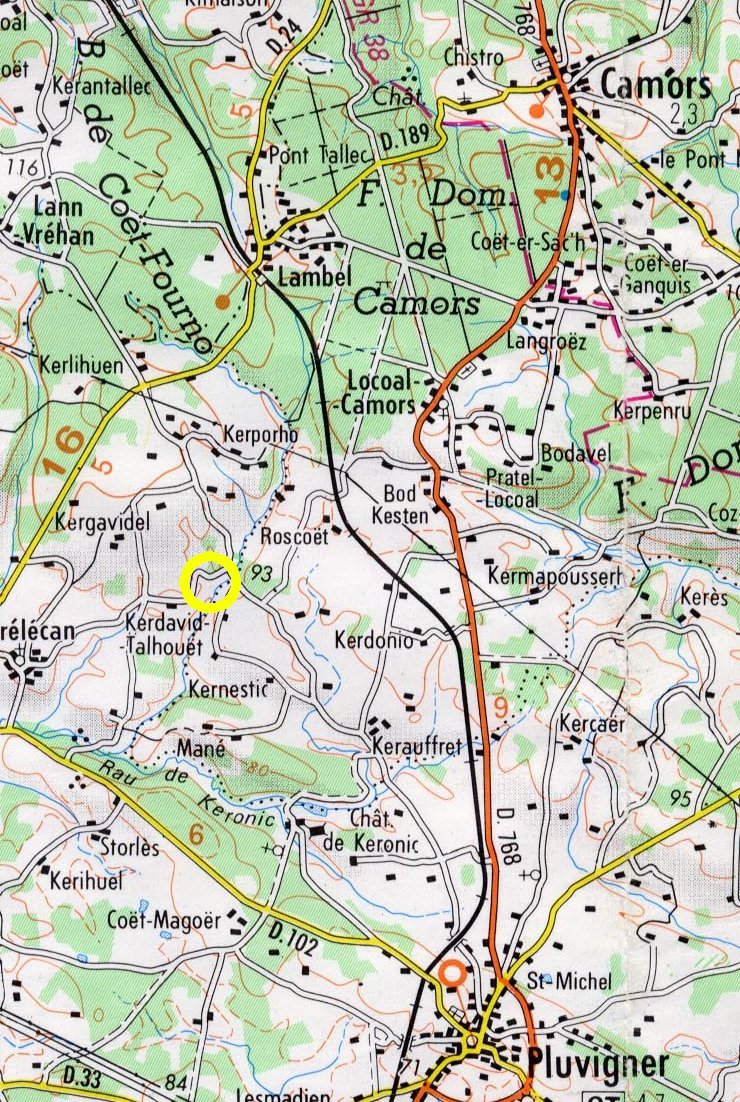
Le Moulin de Chaquel is in the French region of Bretagne,
department Morbihan.
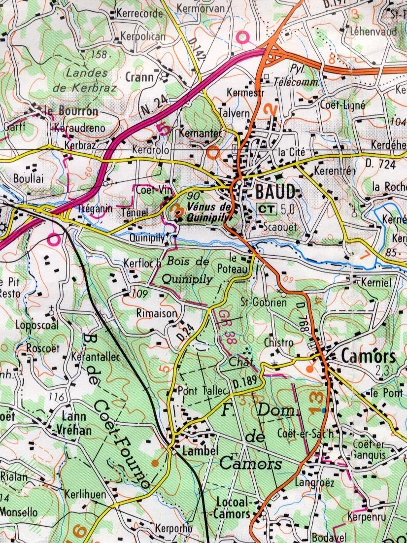
We are just south of the Forêt Domaniale de Camors.
The nearest towns are Pluvigner, about 5k to the
southeast and Camors, about 7k to the northeast.
We are about 10k south of Baud and 15k north of Auray and
the Golfe du Morbihan. The Riviére d'Etel is about
10k to the southwest of us.
On leaving the ferry port, follow signs for
Rennes or Vannes / Lorient. The road you need to head
for is the N24 that runs between Rennes and Lorient.
You
normally join this road as you exit Rennes (or
join it at Ploërmel if coming from St Malo on the D766 Dinan
to Vannes road). Stay on the N24, direction
Lorient, the exit you need is the one for Baud & Auray.
If you carry on to the next exit, about 5k, (the
one recommended for lorries) you avoid going through
the town.
Within a couple
of hundred metres, cross the railway bridge and go on through
more forest. Watch for the next crossroads, they are about
1k from the bridge (there is a blue
bus stop just before it), and turn left, direction
Kerglouéro & Botquestén.
(Note that the opposite road, off to the right, is signposted
Quistinic.)
|
|
|
Our local area Camors to Pluvigner
|
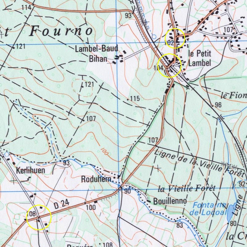
Pass
through Kerglouéro and then Botquestén. About 1k from
the crossroads you start going downhill. Look out for the
right hand turn, direction Trélécan & Kerdavid Talhouët
(the turn is indicated by a diagonal cross but the signpost
faces away from your direction of travel). As you
turn right, our land is on your left hand side. Turn
next left into our drive.
Directions
from Auray Station.
As you leave the
main station entrance, turn left and then left again, over
the rail tracks in the direction Pluvigner. Stay on this
road until it meets the D768. Turn right, direction Pluvigner.
Stay on the D768 all the way Pluvigner, it's about 11k.
As you approach
Pluvigner, there is a roundabout, go straight over towards
the town centre. Go throught the town until you see the
Mairie. The road you want is the one "behind"
the Mairie. You can either turn in front or just after the
Mairie. You know if your on the right road if there is a
big sports ground (High wall) on your right. Follow that
road out of town, passing under a small rail bridge, then
bearing round to the right.
Stay on this road
for about 4k until you see the sign for Trélécan & Kerdavid
Talhouët. Turn left, our land is on your left hand side
and then take the next turn left into our drive.
Welcome to Le Moulin de Chaquel!